



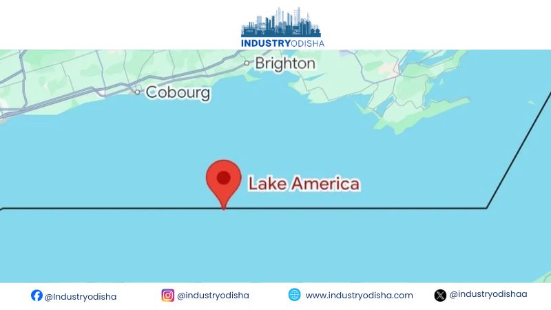
Industry Odisha Bureau, Sep 02: Apple has renamed Lake Ontario to “Lake America” on its web-based Apple Maps platform. The update, made Tuesday, follows an executive order signed by President Donald Trump. Alphabet’s Google Maps had already introduced the same designation for United States users. Google made that switch late on Saturday, days before Apple’s own change appeared. Apple’s decision follows Google’s lead among major digital mapping platforms operating in America. The development highlights how government naming decisions can reach into digital mapping products.
Lake Ontario lies along the border between Canada and the United States. The renamed designation currently appears only on the web version of Apple Maps. It remains unclear whether the change will extend to Apple’s mobile applications soon. Trump’s order followed months of rising trade tensions between Washington and Ottawa.
Google previously said its updates reflect official designations from the federal government’s naming database. That government database is known as the Geographic Names Information System, or GNIS. Apple has not confirmed whether it follows the same federal naming database policy. Neither Apple nor Google has issued a detailed statement explaining their internal reasoning.
Canadian users of both Apple Maps and Google Maps still see Lake Ontario. Users outside North America reportedly see both names displayed together on these platforms. That pattern shows the change is localized rather than a worldwide map update. Apple offers Maps across iPhone, iPad, Mac and a newer web-based interface. That newer web version competes directly with Google’s long-established online mapping service.
Neither company has confirmed making any political statement through this naming decision. The chronology simply shows Trump’s order preceding both companies’ subsequent mapping updates. Lake Ontario’s cross-border location adds particular sensitivity to any digital renaming discussion. No Canadian government reaction to Apple’s specific change has been publicly reported yet.
The broader significance lies in platforms adapting displays across differing national naming conventions. Such market-specific mapping choices could recur whenever governments alter official geographic designations. Digital maps now shape how millions of users encounter politically sensitive geographic names. Mapping platforms increasingly must navigate different naming conventions across separate national jurisdictions. This case shows a government-driven name reaching directly into global technology company decisions. The episode underscores how digital cartography now intersects with contested political geography. Whether the label spreads beyond the web platform remains an open question.
