



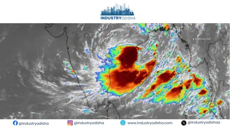
Industry Odisha Bureau, Sep 23: A deep depression over the Bay of Bengal is set to cross the coast tonight. The system will hit the north Andhra Pradesh and south Odisha coasts. Landfall is expected between Visakhapatnam and Gopalpur, near Kalingapatnam, by September 23 night.
The India Meteorological Department’s (IMD) Bhubaneswar centre issued a special bulletin on Wednesday. At 5.30 am, the system lay about 70 km east-southeast of Kalingapatnam. It was also nearly 150 km south of Gopalpur. The deep depression is moving west-northwestward at 12 kmph. It is packing sustained winds of 55 to 65 kmph, gusting up to 75 kmph.
Heavy rain lashes south Odisha
Heavy rain lashed south and coastal Odisha in the 24 hours ending Wednesday morning. Similiguda in Koraput district recorded the highest rainfall at 23 cm. Jayapur received 16 cm, while Berhampur logged 15 cm. Borigumma and Tentulikhunti recorded 14 cm each. Baleswar and Nandahandi received 13 cm. Gopalpur, Remuna and R. Udayagiri logged 10 cm each.
Red alert in four districts
The IMD has issued a series of district wise warnings till September 27. A red warning is in force in four districts until 8.30 am on Thursday. These are Koraput, Malkangiri, Kalahandi and Nawarangpur. They may see heavy to very heavy rain, with extremely heavy spells at isolated places.
An orange warning covers 12 districts over the same period. They include Nuapada, Balangir, Kandhamal, Rayagada, Gajapati, Ganjam and Puri. Khordha, Nayagarh, Boudh, Sonepur and Bargarh are also on alert.
For September 24& 25, Nawarangpur remains under a red warning. Orange alerts continue for Bargarh, Nuapada, Balangir, Kalahandi, Koraput and Malkangiri among others.
The IMD has also flagged a flash flood risk in southern and central Odisha. Low lying areas and watersheds face danger from runoff and saturated soils.
Rough seas, fishermen warned
Squally winds of 55 to 65 kmph, gusting to 75 kmph, will sweep the coast. They will prevail off south Odisha and north Andhra Pradesh till Thursday evening. Conditions will ease gradually thereafter. The sea will remain very rough over the west central and northwest Bay of Bengal.
Local Cautionary Signal No. 3 (LC-3) has been hoisted at all Odisha ports. Fishermen have been strictly advised to stay off the Bay of Bengal till Thursday. This includes waters off Odisha, Andhra Pradesh and West Bengal.
Possible impact
The IMD warned of localised flooding and waterlogging on urban roads. Power lines and unreinforced structures may suffer minor damage. Tree branches could be uprooted by strong winds. Rail, road and offshore operations may also face disruptions.
Advisory for residents
Residents in vulnerable areas have been asked to stay indoors. They should keep doors and windows shut and unplug electronic devices. People must avoid taking shelter under trees or near water bodies. Travellers are advised to check traffic conditions before setting out.
